

Baltimore Key Bridge collapse: Dali refloated, moved to nearby marine terminal
BALTIMORE - For the first time in almost two months, the container ship that caused the deadly collapse of Baltimore's Francis Scott Key Bridge, is moving.
The Dali had remained at the collapse site since it lost power and crashed into one of the bridge’s supporting columns on March 26.

Baltimore Key Bridge collapse: Dali refloated, being moved to nearby marine terminal
For the first time in almost two months, the container ship that caused the deadly collapse of Baltimore's Francis Scott Key Bridge, is moving.
On Monday, it was refloated and is moving back to port at a nearby marine terminal.
The deadly collision killed six construction workers and snarled traffic into the Baltimore Harbor.
READ MORE: Ship that caused Key Bridge collapse had power blackouts before leaving port: NTSB report
High tide Monday morning brought the best conditions for floating and moving the ship, according to the Key Bridge Response Unified Command.
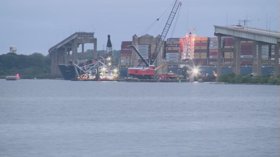
Baltimore Key Bridge collapse: Work begins to refloat Dali, move to nearby marine terminal
As many as five tugboats will escort the Dali on its 2.5-mile (4-kilometer) route to the marine terminal.
The work is expected to last at least 21 hours.
READ MORE: WATCH: Baltimore Key Bridge explodes in controlled demolition
Crews conducted a controlled demolition on May 13 to break down the largest remaining span of the collapsed bridge.
The Dali experienced four electrical blackouts within about 10 hours before leaving the Port of Baltimore for Sri Lanka and hitting the bridge, according to a preliminary report issued by the National Transportation Safety Board.

Baltimore Key Bridge collapse: Dali refloated, being moved to nearby marine terminal
For the first time in almost two months, the container ship that caused the deadly collapse of Baltimore's Francis Scott Key Bridge, is moving.
The Associated Press contributed to this report