

Evacuations ordered in Camp Verde as heavy rain causes severe flooding
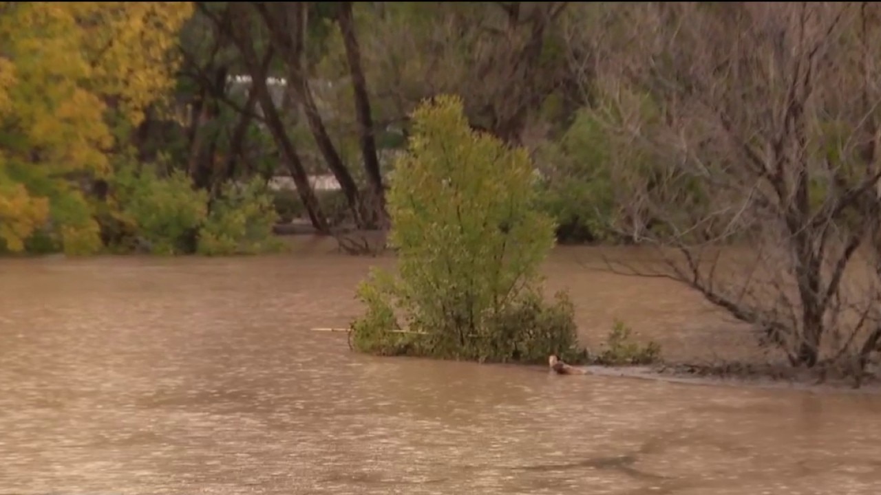
Camp Verde flooding forces evacuations as Verde River rises
The Camp Verde Marshal's Office is asking residents to evacuate as consistent rain drives the Verde River roughly 50 feet past normal levels, threatening homes and livestock. FOX 10's Andrew Christiansen reports.
CAMP VERDE, Ariz. - Flooding emergencies were issued across Camp Verde on Sunday, as heavy rainfall caused significant flooding in the area.
Evacuations:
Residents near the Verde River, West Clear Creek, and Wet Beaver Creek are under "GO" status, meaning they should leave the area immediately and move to higher ground. The area of Bates Road, Comanche, Franquero, and near Rivera Run Drive in Cottonwood are GO status, for zones 1469, 1472, 1460, 1625, 1631, and 1634.
A temporary shelter is available at Camp Verde Parks and Recreation Gym, located at 473 Main Street in Camp Verde.
Areas near Salt Mine Rd.and Beasely Flats are on "SET" status, for zones 2024, 2090 and 2093, as of 3 p.m. on Sunday. Residents in this area should be prepared to leave.
What you can do:
Under these evacuations, officials say to follow directions from law enforcement and emergency personnel, use the designated evacuation routes, obey posted closure signs and traffic control devices, and avoid flooded roads, washes, and low-water crossings. No one should drive around and through barricades or attempt to walk or swim through moving floodwaters. Residents should take any essential medications, family members and pets.
Officials are urging residents to download the Genasys Protect app to identify their evacuation zone, to stay informed and make the best decision to keep families safe. The Marshal's Office said the app provides additional emergency updates and evacuation information.
The public is urged, however, to continue to monitor official public safety announcements, and that the app is merely an additional tool, and should not be the only source of emergency information.
What Residents are Saying:
"I haven't seen it like this in probably 20 years, maybe more," a resident said.
People who live in Camp Verde said it's not often that the Verde River gets this wide.
"I didn't think it was going to get this bad," resident Chuck Arnold said.
Some living along the river say the water line doesn't usually reach this bench or sign, and it's usually at these bushes several feet away. Other neighbor also said the river doesn't normally flow as quickly where Beaver Creek meets the Verde River, getting close to some homes.
"It stinks because I don't have a horse trailer, so I'm trying to figure out how to get my horses and my tortoises and chickens out of there. That's why we're making calls right now. There's a couple of rescue places my wife has called, and they said that they would be able to come and help us," Arnold said.
The other side:
While some people are considering evacuating, others say the water in the river was worse decades ago, so they aren't evacuating.
"Real narrow, it's only about 15, 20 feet wide, used to be about 40 feet wide, and much deeper than it is now," a resident said.
"There's no need. The river has actually gone down over the last three hours," another resident said.
Sandbag Locations:
Camp Verde residents in flood-prone areas are encouraged to pick up sandbags, as additional rain and rising water levels are expected throughout the Verde Valley:
- Fain & Nichols
- Camp Verde Water Company
- Yavapai County Complex
"Please continue to exercise caution around waterways, obey all barricades and road closures, and NEVER attempt to drive through flooded low-water crossings," the Camp Verde Marshal's Office said in a Facebook post. "The safety of our community and your families is our priority."
Need Assistance?:
The Marshal's Office said Firebird Towing of Camp Verde offered to help residents with vehicle removal services who become stranded due to flooding.
"We appreciate Firebird Towing stepping up to help our community during these conditions," they said in a post.
Big picture view:
Some areas of Cottonwood are also under evacuation orders.
What's next:
"The Camp Verde Marshal’s Office would like to remind everyone that river and stream flow rates throughout the Verde Valley are expected to increase over the coming days."
The Source: Information in this report was gathered from official public safety announcements and Facebook posts from the Camp Verde Marshal's Office; statements by resident Chuck Arnold; statements by unnamed Camp Verde residents; and community assistance details provided by Firebird Towing of Camp Verde.