

Arizona weather forecast: More rain, snow expected across the state
Evening Weather Forecast - 3/14/2025
It's been an active couple of days in terms of winter weather, but things are about to change.
PHOENIX - What a week!
Wet weather continues across the state Friday into Friday night, but drier weather will return this weekend.
Today
What We Can Expect:
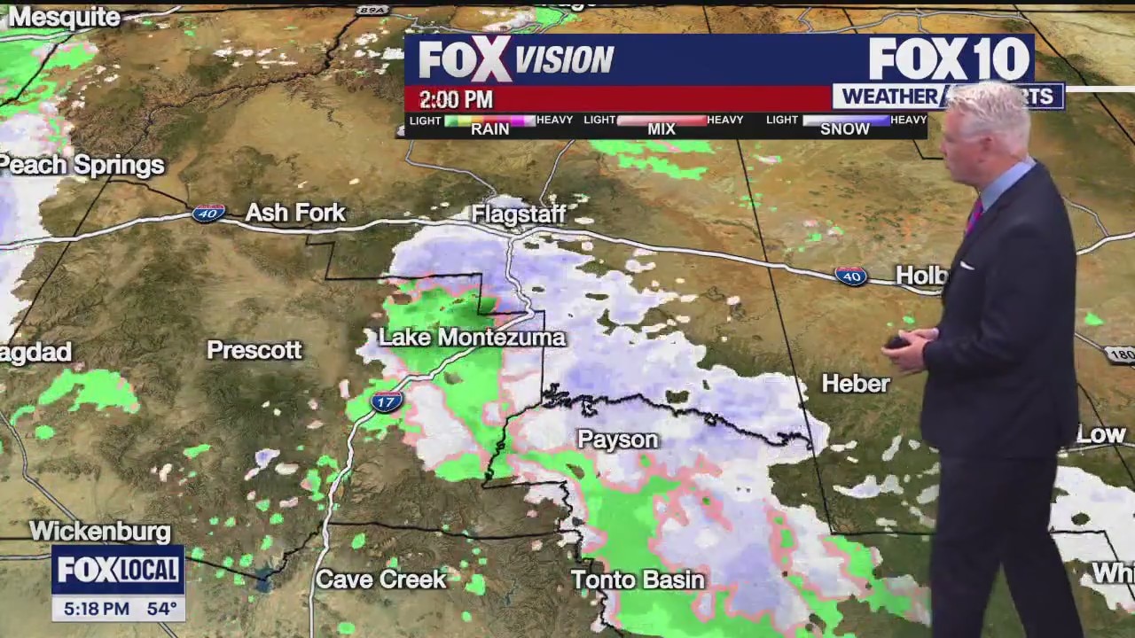
Another cold front and storm system will move across the state through the afternoon and night. This system brings more snow to Northern Arizona and rain to the Valley and Lower Deserts. Winds will not be as strong as Thursday's storm, but will turn breezy to windy, again.
Up in Northern Arizona, snow showers may start as early as 2-4 p.m. However, they will be light and patchy. As the night continues, snow showers will become steadier to at-times heavy. Road conditions will quickly deteriorate with heavier snow bands, and visibility may drop periodically. Totals between 4-8" will be possible in Flagstaff, with 6-12" for Snowbowl and 10+" around Sunrise Ski Park.
In the Valley, rain showers will begin past 4 p.m, mostly light and spotty. They will become heavier and scattered through the evening and into the overnight. Another 0.25" of rain, with heavier pockets, is forecast.

New round of winter storms coming to Arizona
Another round of winter weather is making its way across Arizona, bringing snow to parts of the high country and rain to other parts of the estate. FOX 10's Nicole Krasean has more, from Flagstaff.
Over the Weekend
What To Expect:
Conditions quickly dry out this weekend. Temperatures warm into the upper 60s in Phoenix on Saturday and Mid 70s on Sunday. It will be sunny to mostly sunny both days.
Next week we'll warm to around 80 on Monday, but another quick-passing storm will clip Northern Arizona and drop highs into the low 70s by Tuesday.
You can always check the latest weather conditions by visiting the FOX 10 Phoenix weather page, or download the Free FOX 10 Weather app, which is available on Apple iOS and Android.
Scroll down this page for satellite and radar, day planner, records, current temperatures, 10-day forecast, forecast highs, and recent rainfall totals, plus live video feeds.


Road Conditions
- Call 511 anywhere in Arizona or 1-888-411-ROAD (7623)
- az511.com