

Arizona weather forecast: Heavy rain and high winds expected across Arizona
PHOENIX - It was a rainy and windy weekend across Arizona!
Weekend Rain:
Much of the Valley received around 0.20 to 0.60 inches of rain, with the lightest amounts around a tenth of an inch near Surprise, Peoria and Litchfield Park.
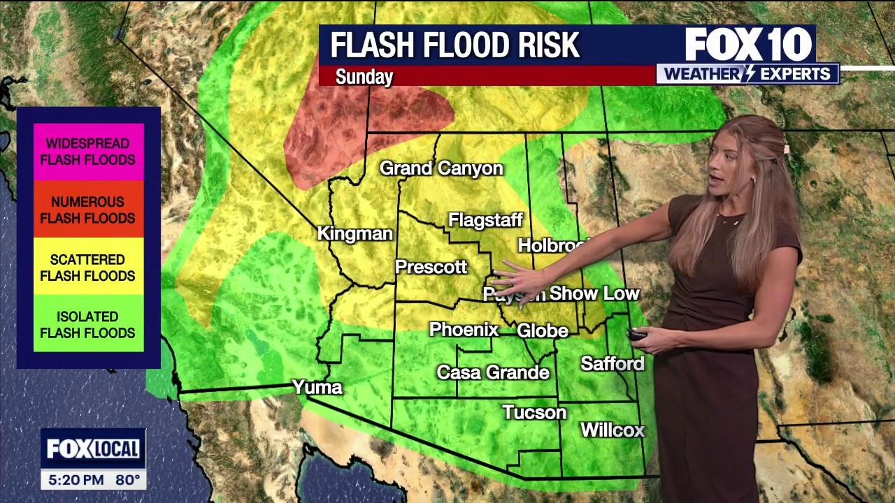
The ground is already saturated from the weekend rain, and additional rounds of rain tonight through Monday may lead to more flash flooding in the high country.
Rain, high winds, and flood risks persist across Arizona
Remnants of Rachel and an upper-level low bring gusty winds, rain, and flash flood risks to Arizona before conditions clear up midweek. FOX 10's Erica Horvatin has the forecast for your upcoming week.
Windy Weather:
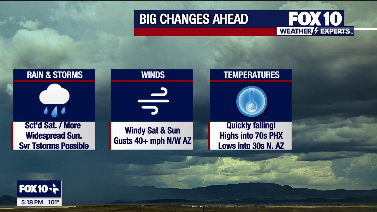
The winds were extremely gusty statewide. Phoenix was wind whipped by 43 mph gusts, and all the High Country and northern Arizona saw winds of 40 to 55 mph. Lake Havasu was the outlier with gusts up to 63 mph.
Winds will lighten up a bit overnight into Monday, with gusts up to 30 mph continuing along the Mogollon Rim. The winds will pick back up on Monday, but not quite to the same caliber. Northern Arizona and the High Country will see 35 to 45 mph wind gusts, and the Valley will see gusts up of 15 to 30 mph. Valley winds will lighten on Tuesday, but the High Country will see gusts of 25 to 40 mph on Tuesday.
Looking Ahead:
More showers and thunderstorms are expected across Arizona through Tuesday. The remnants of Rachel are moving out, but an upper-level low pressure system will keep rain going. Scattered showers and weak thunderstorms will be possible through Sunday night in the High Country. The Valley will be mainly dry, with only some hit-or-miss showers.
On Monday, rounds of showers and storms will be possible from the morning until nighttime. The Valley will see a 30% chance of rain, which looks most likely during the afternoon, evening and overnight hours.
Rounds of rain will continue into Tuesday morning, especially Monday night through Tuesday morning as the cold front moves through the state. After that, skies will start drying out in the Valley, and evening. The High Country will be drier Tuesday afternoon and evening.
Rain chances will linger on Wednesday in northeast Arizona, but Thursday and Friday are going to be dry statewide.
Temperatures will be cooler than normal all week. Humidity will be noticeable on Monday, but drier air will take over Tuesday, allowing for comfortable and cool temperatures in the upper 70s and 80s for most of the work week!
Saturday:
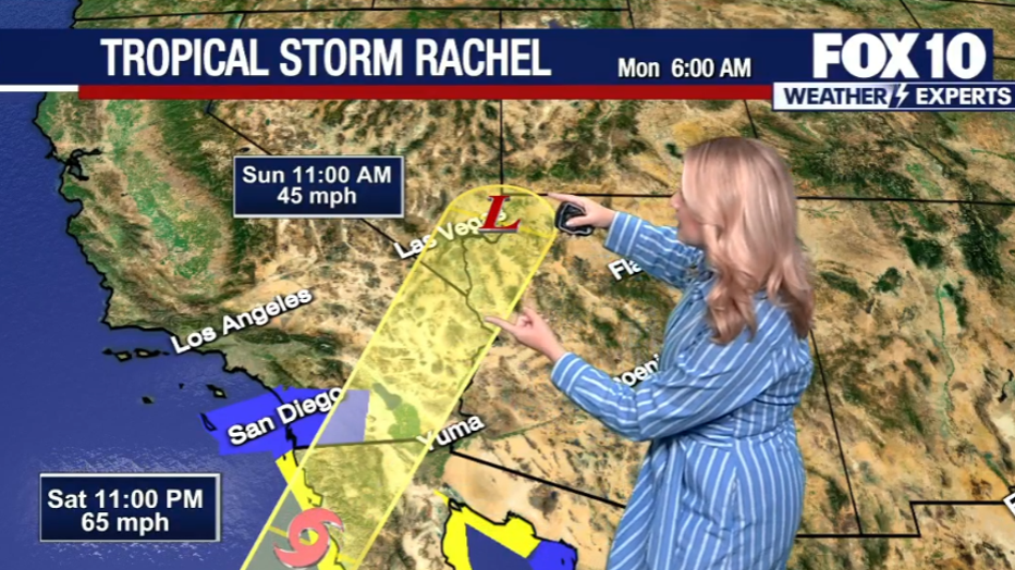
Spotty showers Saturday morning gave way to more active storm development Saturday afternoon. Tropical Storm Rachel has begun to spin up into our larger weather pattern, driving a hybrid storm of moisture and cooler air toward the Southwest.
Rain chances and strong wind gusts move into Arizona
Tropical Storm Rachel is tracking toward Southern California and Arizona, bringing heavy rain bands, strong wind gusts, and flood watches to parts of the state through Sunday. FOX 10's Ashley Loaeza has the latest.
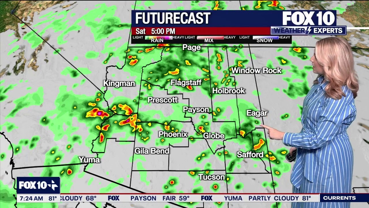
On Saturday afternoon, we reached a high temperature of around 92 in Phoenix. This began a day-long cooldown in our region. In Phoenix, spotty showers will be possible through mid-afternoon with scattered thunderstorms possible later in the afternoon and lasting into the night.
Tropical Storm Rachel to bring heavy rain, severe storms, and 50 mph winds to Arizona
Tropical Storm Rachel is tracking along Arizona's western border, bringing severe thunderstorms, high wind gusts, and cooler temperatures across the state this weekend. FOX 10's Krystal Ortiz has the latest.
Saturday night through mid-Sunday was the best window for stronger or severe storms in the Valley.
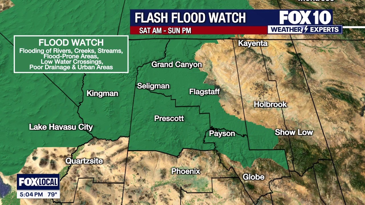
Flood watches have now been posted for much of northern and western Arizona beginning on Saturday morning and extending through Sunday evening.
Widespread storms headed for Arizona this weekend
Storms spanning the state are headed our way, and they're cooling down our temperatures quite a bit, too. FOX 10's Ashley Loaeza has what you need to know.
Expected Rain Totals:
In the northwestern quarter of Arizona, the highest rain totals are expected where pockets of over 2" of rain may be possible, especially in locations with a "lift assist" via higher elevation. A general 1–2" of rain will be possible in that area of northern/western Arizona.
This Past Friday:
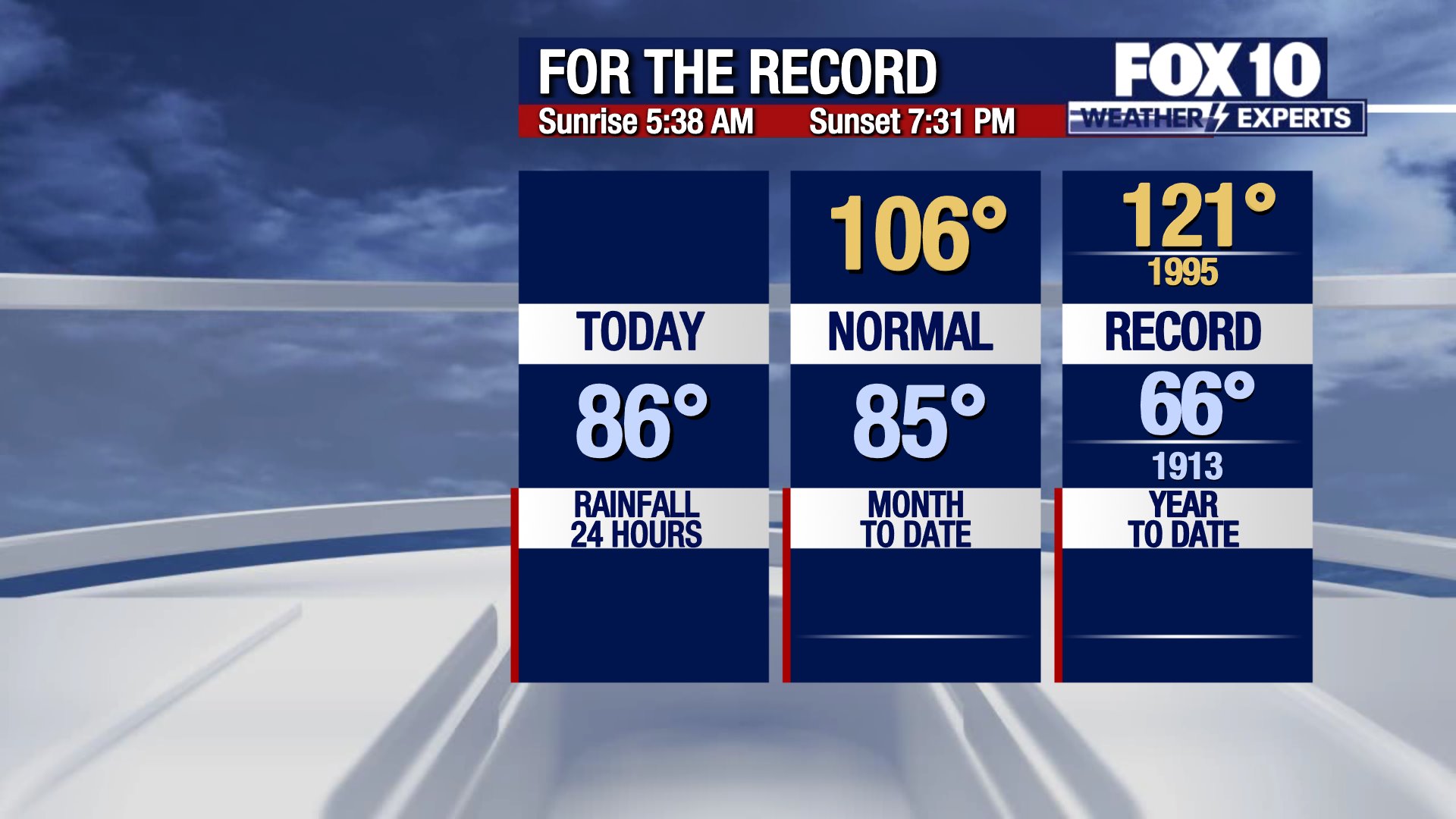
On Friday, Phoenix hit a high of 104 degrees with the norm sitting at 92 degrees. Temperatures will considerably drop due to the remnants of tropical storm Rachel and multiple systems ushering in widespread rain activity across the state for the next couple of days.
You can always check the latest weather conditions by visiting the FOX 10 Phoenix weather page, or download the Free FOX 10 Weather app, which is available on Apple iOS and Android.
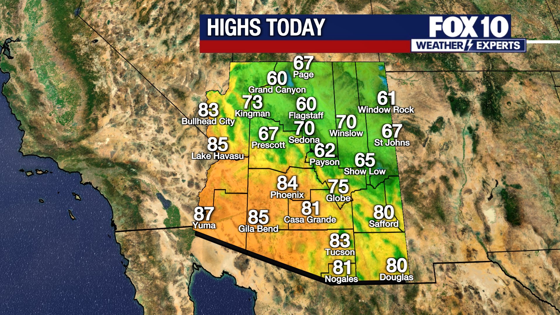
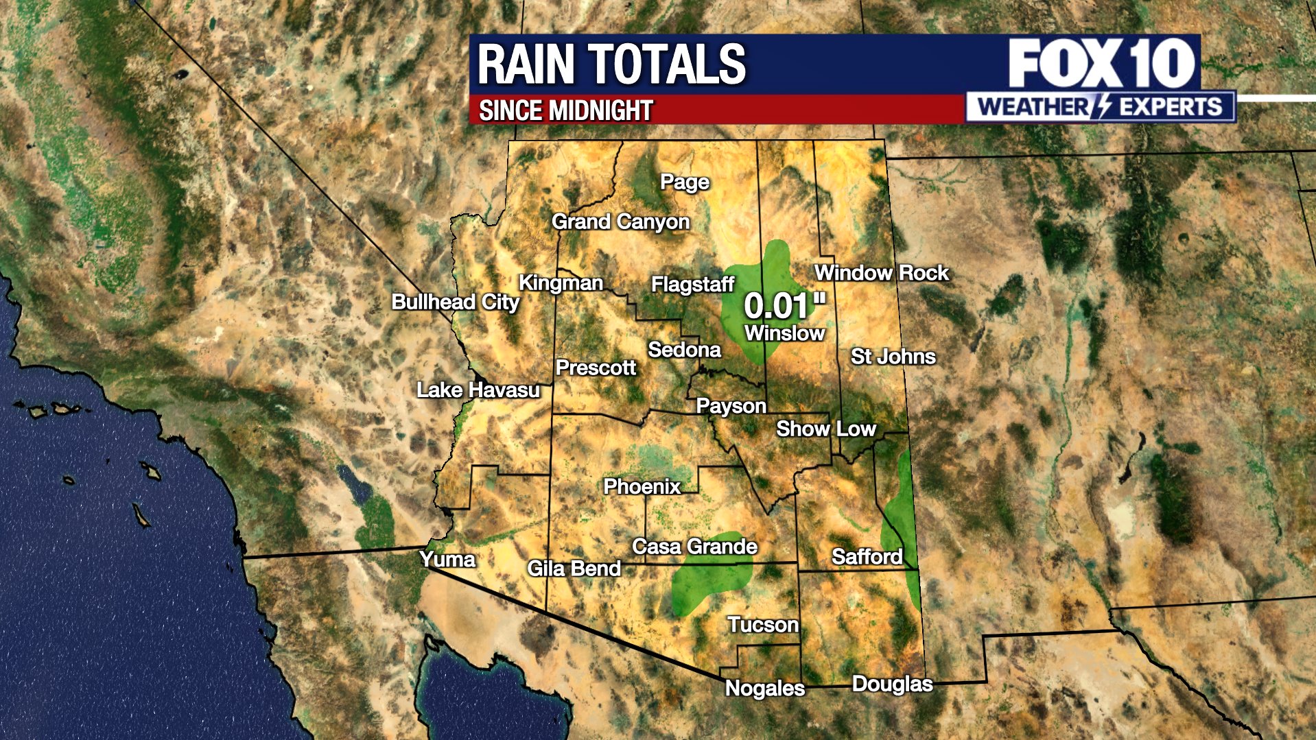
Scroll down this page for satellite and radar, day planner, records, current temperatures, 10-day forecast, forecast highs, and recent rainfall totals, plus live video feeds.





The following heat safety information was provided by the Scottsdale Fire Department.
What are Heat Emergencies?
Heat Cramps: Profuse sweating, fatigue, extreme thirst, muscle cramps
Heat Exhaustion: Headache, dizziness, weakness, nausea/vomit, Cool/moist skin
Heat Stroke: Elevated temp. +103degrees, confusion/irrational behavior, dry/hot skin, rapid shallow breathing, rapid weak pulse (shock), seizures, unconscious
What to do
- Get person into shade or cool location.
- Cool person with cool, wet cloths (neck, groin, armpits, head) and fan body.
- Sip cool water if person is alert.
- For muscle cramps, massage muscles gently, but firmly until relaxed.
- *If symptoms worsen, call 911.
What not to do
- Do not give anything by mouth if person is vomiting, unable to swallow or unconscious.
- Do not underestimate the seriousness of a heat emergency.
- Prevention/Preparation for hike/exercise in heat.
Know your limitations
- Hydrate (begins day prior to hike/exercise, hour before hike, during and after).
- Wear proper clothing, lightweight and light color, protect head, proper shoes.
- Always carry a cell phone and best to hike with company.
- Always tell someone where you are hiking and when to plan to return.
Preventing heat exhaustion/heat stroke
The Arizona Department of Health Services stated the following precautions can be taken to prevent heat exhaustion or heat stroke:
- Stay in air-conditioned buildings.
- Find a cooling center/hydration station.
- Limit outdoor activity during the hottest part of the day (mid-day).
- Check on at-risk friends, family, and neighbors at least twice a day.
- Drink water before, during, and after working or exercising outside.
- Check the UV Index.
- Check the heat risk map.
Road Conditions
- Call 511 anywhere in Arizona or 1-888-411-ROAD (7623)
The Source: Information for this article was gathered by the FOX 10 Weather Experts.