Tropics watch: Idalia, Franklin, Jose, Gert, soon-to-be Katia, Depression 12 jam the Atlantic
The Atlantic Ocean has transformed into a tropical traffic jam, bustling with activity as the National Hurricane Center is tracking several disturbances, including four named storms and a fifth coming soon.
WHAT TO EXPECT IN SEPTEMBER DURING HURRICANE SEASON
Post-Tropical Cyclone Idalia is still swirling just off the Atlantic Coast and may still affect Bermuda and bring other impacts to the Eastern Seaboard. Meanwhile, farther out to sea, Hurricane Franklin and Tropical Storm Jose are on a collision course, with Tropical Depression Gert regenerating back from the dead and spinning just to those storms' south.
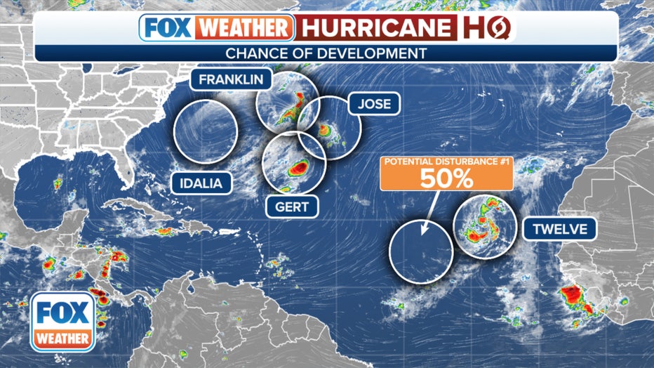
Another tropical disturbance just off the western African coast is on the cusp of possibly becoming Tropical Storm Katia, and forecasters are eyeing another future disturbance that is showing signs of developing off western Africa in the coming days.
Here's a closer look at each of the tropical systems swirling out in the Atlantic:
Hurricane Franklin and Post-Tropical Cyclone Idalia still ongoing
Post-Tropical Cyclone Idalia and Hurricane Franklin are still the two largest tropical systems in the Atlantic basin..
Idalia made a historic landfall in Florida's Big Bend region on Wednesday as a Category 3 hurricane and has caused a large swath of damage from storm surge, flooding and 80+ mph wind as it trekked across southern Georgia and through the Carolina coasts before heading out in the Atlantic.
HURRICANE IDALIA, HURRICANE FRANKLIN PUT ON POWERFUL SHOW AS SEEN FROM SPACE
Idalia is still causing some dangerous rip currents and heavy surf along the southeastern U.S. coast as Labor Day weekend gets under way, though the beach conditions should improve as the weekend progresses and Idalia moves farther away.
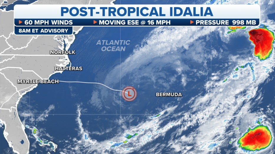
On the other hand, Bermuda is still in Idalia's sights and Tropical Storm Warnings are in effect. Idalia was 185 miles west of Bermuda and was moving east at 17 mph. The NHC warns Bermuda may see some flash flooding from heavy rains as Idalia passes along with strong wind gusts.
Idalia was considered "post tropical" on Friday – it merged with a cold front off the North Carolina coast meaning it was technically no longer getting its primary source of energy from warm ocean waters. But Idalia was expected to reenergize as a tropical storm Saturday as the front faded and the storm brushes by Bermuda.
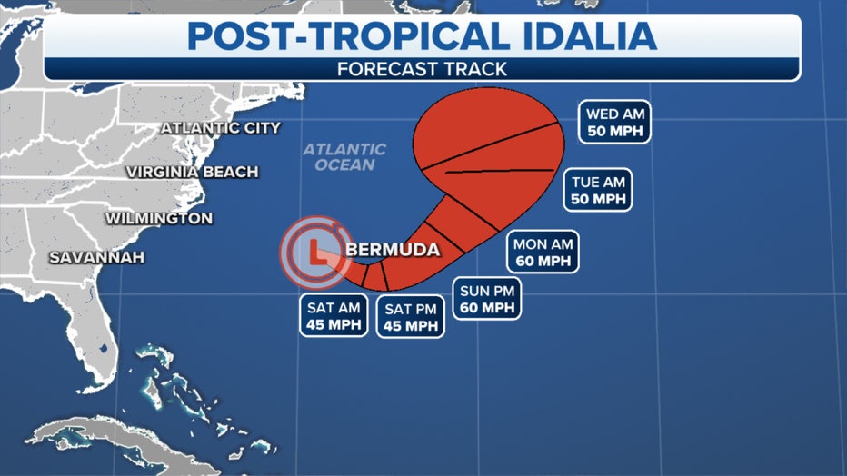
Once Idalia passes Bermuda, its future path is uncertain. The consensus of the computer forecasts is that Idalia will eventually get swept out to sea, says FOX Weather Hurricane Specialist Bryan Norcross. However, "a credible number turn it back toward New England or Atlantic Canada… bringing it uncomfortably close to the coast next week as a non-tropical storm. Stay informed in New England until its path is clear."
Franklin's still churning along with 75 mph winds but its impacts to the U.S. are finished – now far enough away to not really cause any more issues along the East Coast beaches. All that's left is to feast on Tropical Storm Jose, heading into its path.
Speaking of Jose…
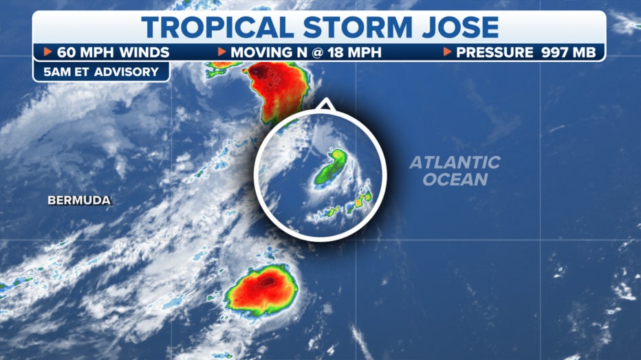
Tropical Storm Jose lingers on its final days
Tropical Storm Jose had been gaining strength Friday but reversed course later in the day, with peak sustained winds dropping to 50 mph. It's weakening in its final hours as it's on a collision course with nearby Hurricane Franklin. Jose will be absorbed into the larger storm by Friday night.
"They’re close to each other and they have a criss-crossing pattern," said FOX Weather Meteorologist Jane Minar. "You’ve got this intersection here, and you’re going to see almost like a Pac-Man (situation) with Franklin just kind of gobbling up Jose and its just going to become one big monster storm in the North Atlantic."
Tropical Depression Gert makes a brief comeback
Tropical Depression Gert had fizzled days ago, but its remnants have staged a comeback in a very crowded area of the Atlantic.
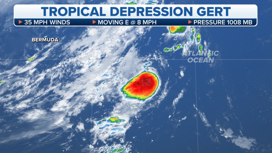
Situated just about 100 miles south of the Franklin and Jose tandem, Gert will have a front-row seat to those two storms' collision Friday night. While that plays out, Gert may strengthen back into a tropical storm at some point Friday.
Gert remains no threat to land and is forecast to weaken a second time over the weekend.
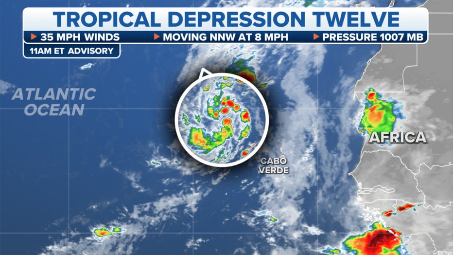
Invest 94L becomes Tropical Depression Twelve Friday as it swirls near Africa
A tropical wave near the west coast of Africa is now designated as Tropical Depression Twelve. It has been showing signs of better development Friday, with an increase in thunderstorm activity and more general organization.
The storm has peak winds of 35 mph and will likely eventually become Tropical Storm Katia later Friday. However, the NHC only gives it through the weekend before it fizzles.
NAMES FOR 2023 HURRICANE SEASON
Another tropical disturbance may form next week off Africa
As if the ocean wasn't busy enough, long range forecasts suggest favorable conditions for another tropical disturbance to form off the western African coast next week.
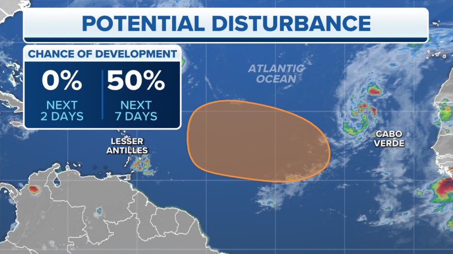
Environmental conditions in the tropical Atlantic look quite favorable for storm development next week, and forecasters will be watching the area closely as these disturbances begin to develop.
Right now, NHC forecasters are giving a 50% chance of development in an area well off of the coast of Africa within the next week.

