

Pocket Fire: Massive multi-agency response unites to defend Sedona and Oak Creek Canyon
(Earlier Report) Pocket Fire forces Oak Creek Canyon evacuations
The Pocket Fire has burned 100 acres north of Sedona, triggering mandatory evacuations for residents in Oak Creek Canyon area. An evacuation center has been set up in Sedona.
COCONINO COUNTY, Ariz. - A wildfire burning near Sedona has resulted in evacuation orders and highway closures.
What we know:
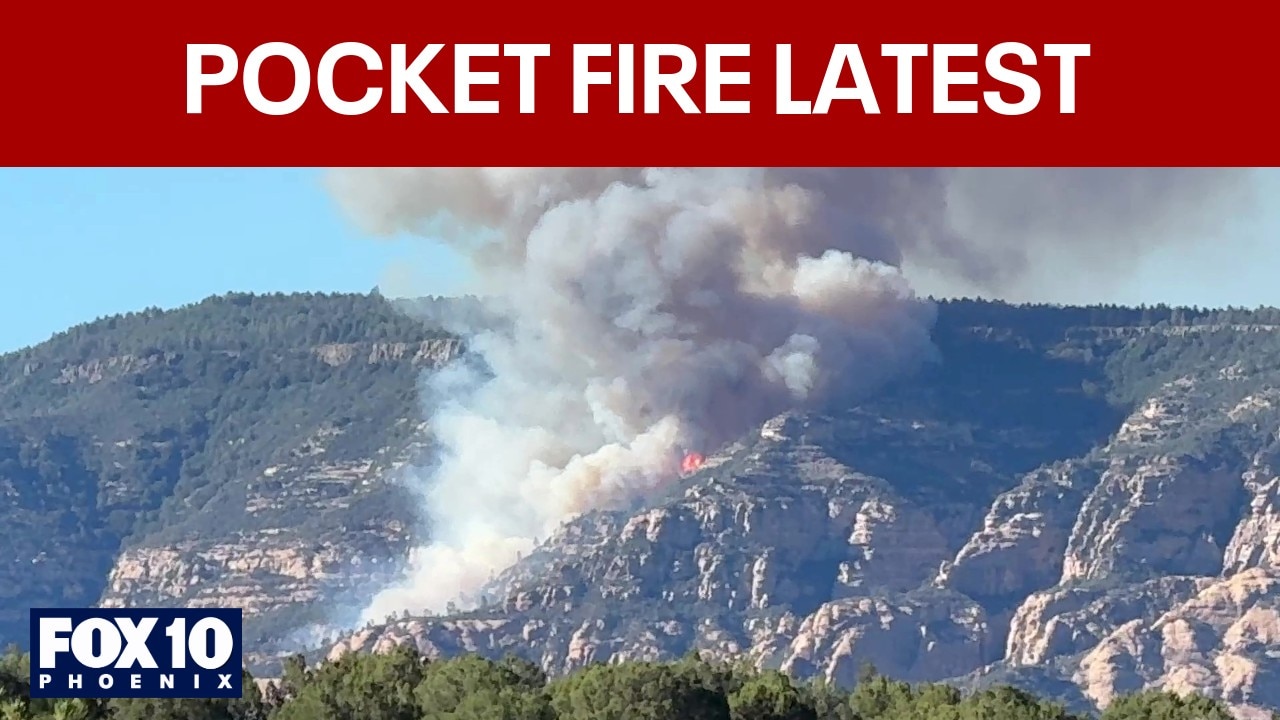
According to the U.S. Forest Service, the Pocket Fire has burned 500 acres of land about 7 miles north of Sedona since it was first reported at around 5 p.m. on June 19.
Firefighters have successfully established a dozer line north and east of the fire, and operations are continuing further to the west on Saturday. While engine crews are currently in Slide Rock evaluating the area and starting prep work, officials note the fire is not moving into Oak Creek Canyon as of now. Precautionary prep work is also underway at the Seven Canyons Resort in case the fire moves further down south towards Sedona.
USFS officials said visitors in the Oak Creek Canyon area, as well as visitors to End/Edge of the World are asked to evacuate. "Travel down Woody Mountain Road (Forest Road 231) is not advised at this time," read a portion of the statement.
The Coconino National Forest says State Route 89A remains closed between Fort Tuthill and the north end of Sedona.

(Courtesy: Klaasjan Tukker)
What they're saying:
Jayson Coil, assistant fire chief for the Sedona Fire District, told FOX10 there are no restrictions for visitors coming into Sedona except the long queue of traffic on Red Rock Scenic Byway. "We're seeing more people on the weekends...everything is very, very busy." Working wildfires around the U.S., Coil said the multi-agency support is exceptional in Northern Arizona. "It makes it easier for us to take care of the public and the firefighters," he said.
On social media, Sedona Fire stated: "It’s been a long night, but we have our best on it. The Pocket Fire has been a proving grounds for a multi-agency collaborative effort to protect life, property and the beautiful nature we are surrounded by."
Dig deeper:
Resources assigned to the fire have scaled up and now include six total helicopters, with air tankers to be used as needed. This adds to the two Hotshot crews, one dozer, five engines and miscellaneous overhead previously deployed.
Local perspective:
Red Cross Arizona officials say an evacuation center has been set up at Red Rock Jr. High School. Melissa Randazzo with Coconino County confirmed that there were four people at the shelter last night.
The extensive list of agencies involved also includes the Coconino National Forest, Sedona Fire District, City of Sedona, Sedona Police Department, Arizona Department of Transportation, Coconino County Sheriffs Office, Yavapai County Sheriffs Office, City of Flagstaff, Arizona Game and Fish, Arizona Department of Public Safety, Camp Navajo Fire Department, and Highlands Fire District.
Where the evacuation center is located
The Source: Information for this article was gathered from the United States Forest Service's website.