

Arizona weather forecast: Flash flood watches, warnings active as Hurricane Polo remnants hit the state
Flash flood warnings hit Kingman and Yavapai County
Severe thunderstorms bring street flooding to Kingman, rapid river rises near Black Canyon City, and heavy rain across Arizona. FOX 10's Cory McCloskey has the latest on the flash flood warnings across Arizona.
PHOENIX - Cloudy skies, widespread rain, and thunderstorms are moving across the region as remnants from Hurricane Polo moves across Arizona.
Tuesday:
The active weather pattern is driven by two combined weather setups. A low-pressure system positioned to the north and northwest is interacting with the southern remnants of Hurricane Polo. Hurricane Polo is expected to make landfall along the Baja peninsula north of Cabo San Lucas before moving along northern Mexico. Positioned directly between both systems, Arizona is receiving heavy precipitation.
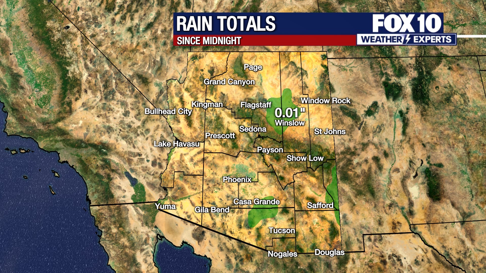
Heavy rainfall persisted across the state through the morning hours. While the Phoenix metro area dried out by the afternoon, higher elevations—including eastern Arizona, the Four Corners region, the Navajo Nation, and the Hopi Reservation—will continue to experience significant rainfall.
Flood Watches/Warnings:
Heavy weather continues to work its way through Mohave County toward Kingman. Street flooding has been reported in the area. A flash flood warning remains in effect until 5:45 p.m. High-risk locations include rivers, creeks, streams, flood-prone areas, low-water crossings, urban spots with poor drainage, and recent wildfire burn scars where the ground has not fully recovered. Strong weather has also been moving through Yavapai County, impacting Prescott, Paulden, Chino Valley, nearby small towns, and wooded areas with running creeks.
Farther east, the Agua Fria River jumped up about 4.5 feet in a short period as strong thunderstorms worked over and north of the area. The water began working through Black Canyon City and flowing southward toward Lake Pleasant. Conditions along that rugged stretch of the Agua Fria River remain treacherous.
North and east of Rio Verde, heavy weather rolled over the burn scar left by the Sandstone Fire from the summer of 2024, which burned almost 30,000 acres near Sunflower. The storm caused flooding across the neighborhood, which includes Round Valley, the Valentine Trailhead, and Sugarloaf Mountain.
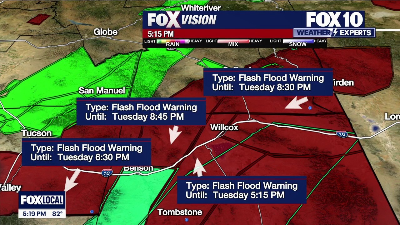
Flood advisories are active near and around Safford. Flash flood warnings are in effect across southeastern Arizona where very strong storms continue a northeasterly track from Safford toward the New Mexico line. Meanwhile, conditions across the White Mountains have quieted down to moderate showers.
More Active Weather:
Strong weather pushing up the Beeline Highway is impacting Payson, with the tail end of the storm moving toward Christopher Creek, Star Valley, and Woods Canyon Lake. Rim Country residents should prepare for the storm as it moves up and over the Rim. Showers are also moving across Munds Park, Sedona, south and west of Camp Verde, Cottonwood, Jerome, and Flagstaff.
Sunshine on the Way:
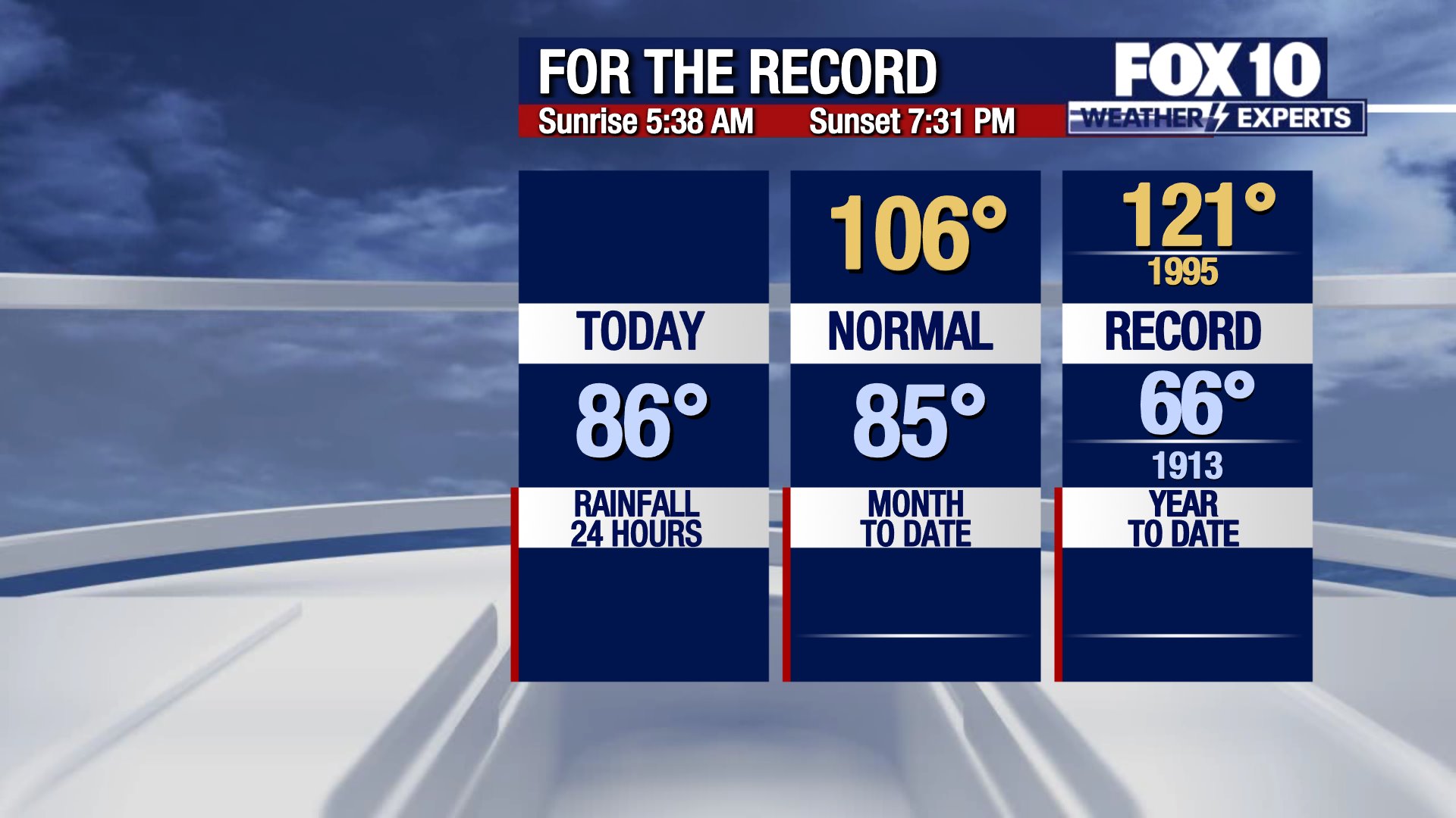
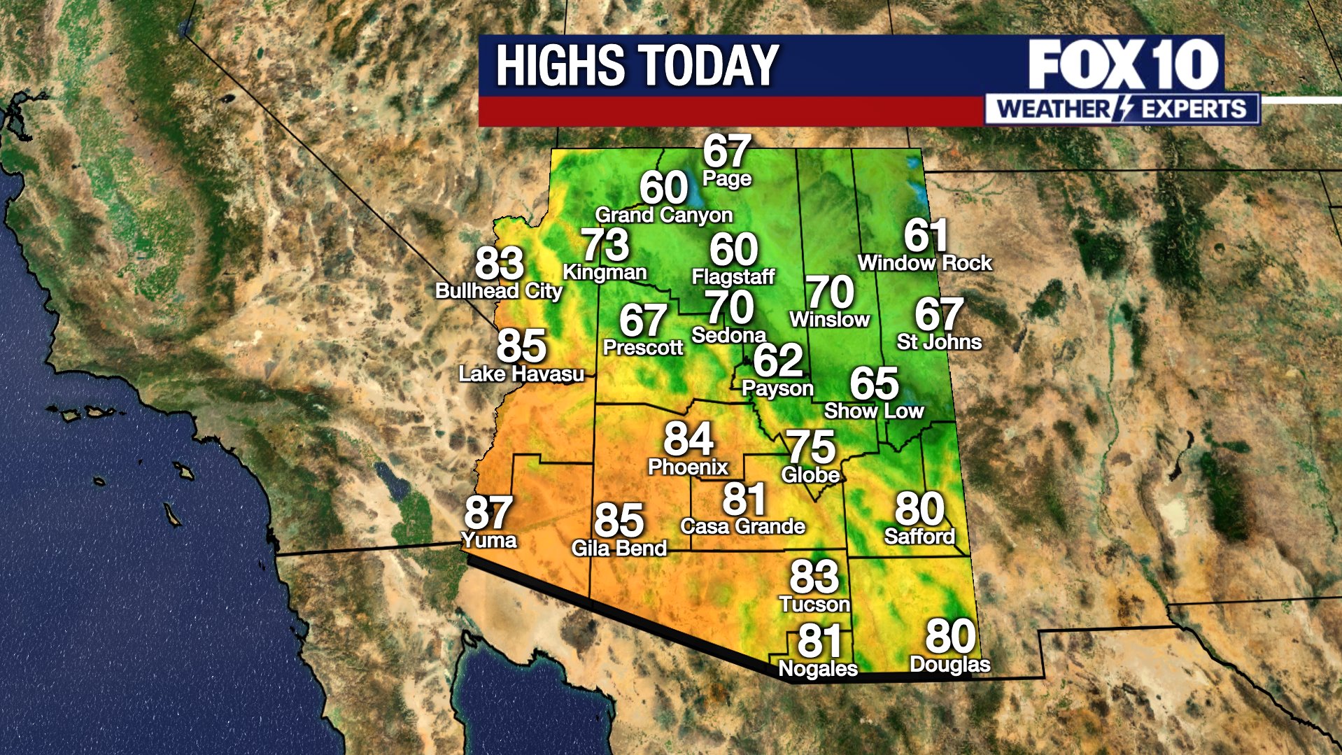
Morning rain and thunderstorms in the Phoenix area gave way to drying conditions by the afternoon. The warm storm system will keep humidity high, with an expected afternoon high temperature of 82 degrees and a 60% chance of rain.
Clearer skies return on Wednesday afternoon with a high of 86 degrees and mostly sunny conditions. Arizona is expected to see sunny skies and typical temperatures returning statewide by Thursday.
What Happened This Morning?:
Radar scans show fast-moving storms and frequent lightning strikes passing over Flagstaff. Clouds shroud Sedona, while precipitation impacts communities further south, including Pine, Payson, Tonto Basin, and Wickenburg.
In the Phoenix metro area, conditions vary by location. East Valley communities like Mesa remain mostly dry, while Sun Lakes received overnight rainfall. The heaviest local precipitation is concentrated in the West Valley along Loop 303 and Loop 101. Motorists traveling north along Interstate 17 from Phoenix toward Flagstaff face a rainy drive. Heavy lightning and strong storm cells are impacting areas just east of Cave Creek and Carefree.
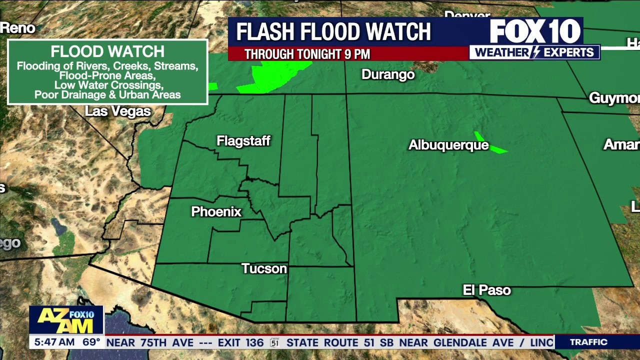
Hurricane Polo remnants move across Arizona
Remnants of Hurricane Polo bring heavy precipitation and lightning to the High Country and the Valley on Tuesday.
Travelers heading west toward Los Angeles could expect rain until reaching Blythe, while those heading north to Las Vegas may have encountered rain until passing Kingman. Widespread storm activity also spans areas east and west of Flagstaff, including Holbrook.
You can always check the latest weather conditions by visiting the FOX 10 Phoenix weather page, or download the Free FOX 10 Weather app, which is available on Apple iOS and Android.
Scroll down this page for satellite and radar, day planner, records, current temperatures, 10-day forecast, forecast highs, and recent rainfall totals, plus live video feeds.





The following heat safety information was provided by the Scottsdale Fire Department.
What are Heat Emergencies?
Heat Cramps: Profuse sweating, fatigue, extreme thirst, muscle cramps
Heat Exhaustion: Headache, dizziness, weakness, nausea/vomit, Cool/moist skin
Heat Stroke: Elevated temp. +103degrees, confusion/irrational behavior, dry/hot skin, rapid shallow breathing, rapid weak pulse (shock), seizures, unconscious
What to do
- Get person into shade or cool location.
- Cool person with cool, wet cloths (neck, groin, armpits, head) and fan body.
- Sip cool water if person is alert.
- For muscle cramps, massage muscles gently, but firmly until relaxed.
- *If symptoms worsen, call 911.
What not to do
- Do not give anything by mouth if person is vomiting, unable to swallow or unconscious.
- Do not underestimate the seriousness of a heat emergency.
- Prevention/Preparation for hike/exercise in heat.
Know your limitations
- Hydrate (begins day prior to hike/exercise, hour before hike, during and after).
- Wear proper clothing, lightweight and light color, protect head, proper shoes.
- Always carry a cell phone and best to hike with company.
- Always tell someone where you are hiking and when to plan to return.
Preventing heat exhaustion/heat stroke
The Arizona Department of Health Services stated the following precautions can be taken to prevent heat exhaustion or heat stroke:
- Stay in air-conditioned buildings.
- Find a cooling center/hydration station.
- Limit outdoor activity during the hottest part of the day (mid-day).
- Check on at-risk friends, family, and neighbors at least twice a day.
- Drink water before, during, and after working or exercising outside.
- Check the UV Index.
- Check the heat risk map.
Road Conditions
- Call 511 anywhere in Arizona or 1-888-411-ROAD (7623)
Rain/flood safety tips
The American Red Cross' tips for heavy rain situations and flood safety:
- Turn around don’t drown! If you must drive and you encounter a flooded roadway, turn around and go another way.
- If you are caught on a flooded road and waters are rising rapidly around you, get out of the car quickly and move to higher ground.
- Tune in to your local radio, NOAA radio, or news channels for the latest updates.
- If your neighborhood is prone to flooding, be prepared to evacuate quickly.
- Follow evacuation orders and do not attempt to return until officials say it is safe.
- If power lines are down, do not step in puddles or standing water.
- If power is out, use a flashlight. Do not use any open flame as alternate lighting.
Preparing for a severe thunderstorm
The American Red Cross' tips for preparing for a severe thunderstorm:
- Put together an emergency kit.
- Know your community’s evacuation plan.
- Create a household disaster plan and practice it.
- Purchase a battery-powered or hand-crank radio
- Discuss thunderstorm safety with members of your household. Be aware that a thunderstorm could produce flooding.
- Pick a safe place in your home for household members to gather during a thunderstorm. This should be a place where there are no windows, skylights, or glass doors, which could be broken by strong winds or hail and cause damage or injury.
Be prepared and stay safe during the monsoon
"Most Valley residents know how quickly and furiously storms can move in and out, bringing strong winds, dust, rain, and flash flooding. These storms can cause interruptions in services, such as water, power, and gas," stated Captain Ashley Losch of the Glendale Fire Department.
GFD reminds residents of ways they can be prepared and stay safe:
- Have flashlights with extra batteries on hand.
- Have food that can be prepared without the need for cooking or refrigeration.
- Have at least one gallon of clean water for each person in the household.
- Have backup power for anyone requiring power for a medical device.
- Have backup power for cell phones that do not require charging.
- Have a first aid kit ready and accessible.
- Never drive into areas with flowing water; it takes less than 10 inches to wash a car away.
- Avoid flooded areas, such as washes.
- If waters are rising, seek higher ground.
- Do not approach downed power lines, the ground can be energized for up to 200 feet.
- Keep pets indoors during storms.
The Source: Information for this article was gathered by the FOX 10 Weather Experts.