

Arizona weather forecast: Storms to bring more rain, snow to state
4 p.m. Weather Forecast- 3/11/2025
A second round of winter weather is coming up but temperatures have been pleasant on Tuesday.
PHOENIX - There are three rounds of rain and snow in the forecast this week for Arizona.
The most impactful round is expected on Thursday, with rain, snow and gusty winds expected.
Round 1
Tuesday evening through Wednesday morning: There is a Winter Weather Advisory in place between tonight and tomorrow morning for areas above 7,000 ft in northern/eastern Arizona.
The system will come from the west. It brings mostly rain, and some high-elevation mountain snow. Showers start west and spread into Yavapai County before eventually filling out in Maricopa County and spreading across the eastern part of the state.
The steadiest precipitation falls between 11 p.m. tonight and 3 a.m. Wednesday, but continues through 8 a.m. as it tracks eastward. Lingering light showers/drizzle are possible until about midday Wednesday, mostly north and east.
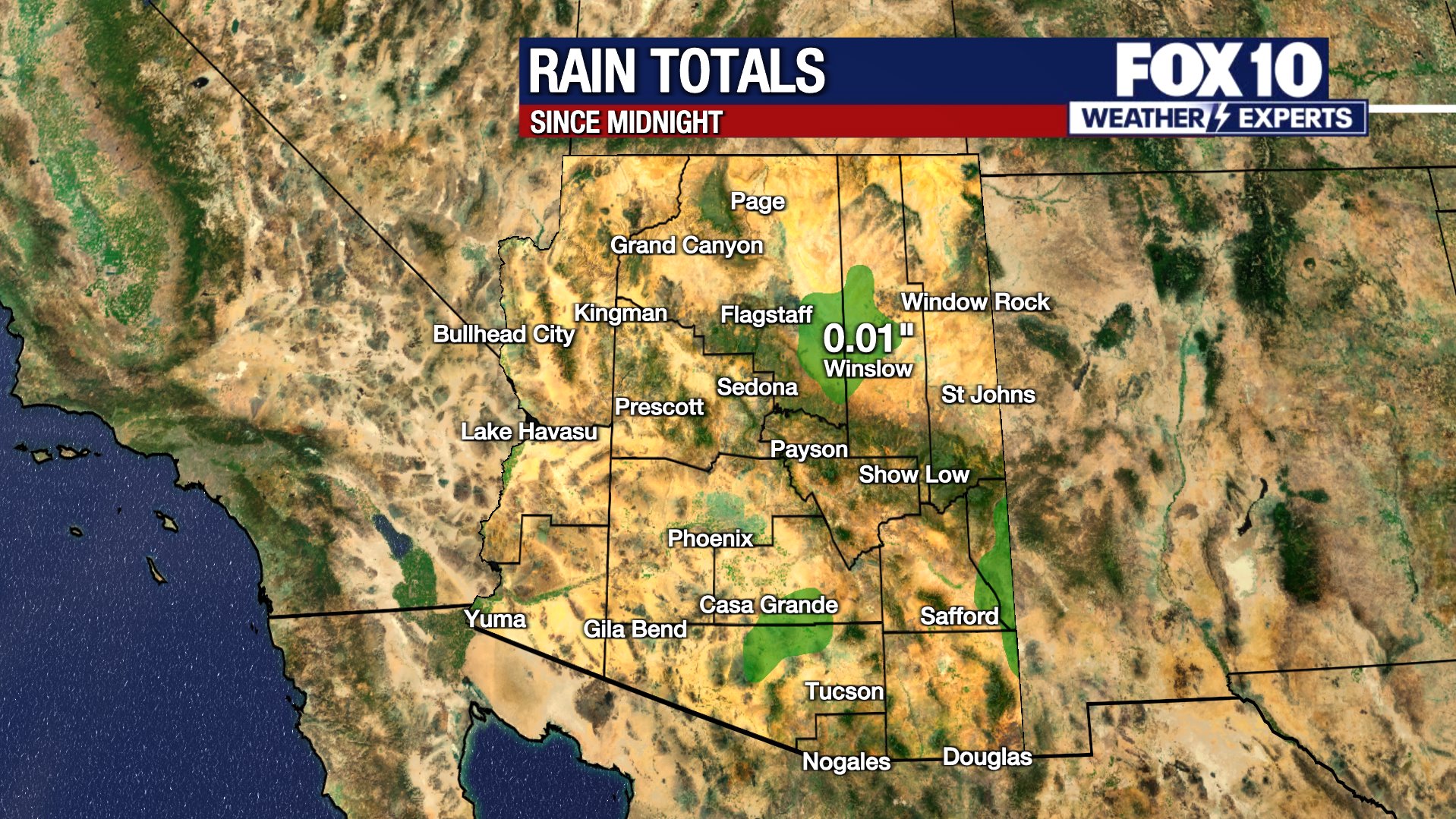
Snow totals of 1-3" are possible in Flagstaff, 4-8" over Snowbowl, 2-5" possible around the rim in the Forest Lakes area, and 1-3" in Pinetop. Higher amounts of up to 5-10" for Sunrise are possible if the storm can hold together as it treks eastward. Rain totals around 0.1" to 0.3" possible in the Valley.
Round 2
Thursday late morning through early Friday morning: There is a Winter Storm Watch in place for Thursday afternoon and night above 6,000 feet.
The system will come from the northwest. It is colder and stronger, so it is expected to be the most impactful. Snow will fall over the northern Arizona mountains with rain in the Valley and lower elevations.
The heaviest precipitation starts west and spreads east through the afternoon. Afternoon into the night will be the heaviest period of precipitation, including snow over northern Arizona. It is likely that the evening commute will be messy in the Valley and potentially dangerous over the mountains.
Drops in visibility, quickly deteriorating road conditions, and snow-packed streets are possible. The snow level may drop through the night, into the foothills north/east of the Valley. It's a bit early for snow totals, but 6-12" in Flagstaff is possible, potentially another 1-1.5 feet of snow for Sunrise and Arizona Snowbowl.
It will be windy throughout the day, too. Gusts of 40+ mph in northern Arizona and 25-25 mph in Phoenix. Blowing snow in the evening may cause issues, and drivers should consider adjusting plans.
Round 3
Friday night through Saturday morning: This round is less certain, since it's still several days out. However, it appears another passage of moisture from the northwest will bring a quick jolt of rain/snow showers. The best chance will be in the north/east parts of the state, but the Valley has a 20% chance of showers.
This will be fast-moving, lighter, and not as impactful, but since it'll be falling on top of Thursday's precipitation, it may cause issues on Saturday morning. As this timeline approaches, we'll need to adjust the chances and totals.
You can always check the latest weather conditions by visiting the FOX 10 Phoenix weather page, or download the Free FOX 10 Weather app, which is available on Apple iOS and Android.
Scroll down this page for satellite and radar, day planner, records, current temperatures, 10-day forecast, forecast highs, and recent rainfall totals, plus live video feeds.


Road Conditions
- Call 511 anywhere in Arizona or 1-888-411-ROAD (7623)
- az511.com