

Arizona weather forecast: Heavy rain and severe storms approaching
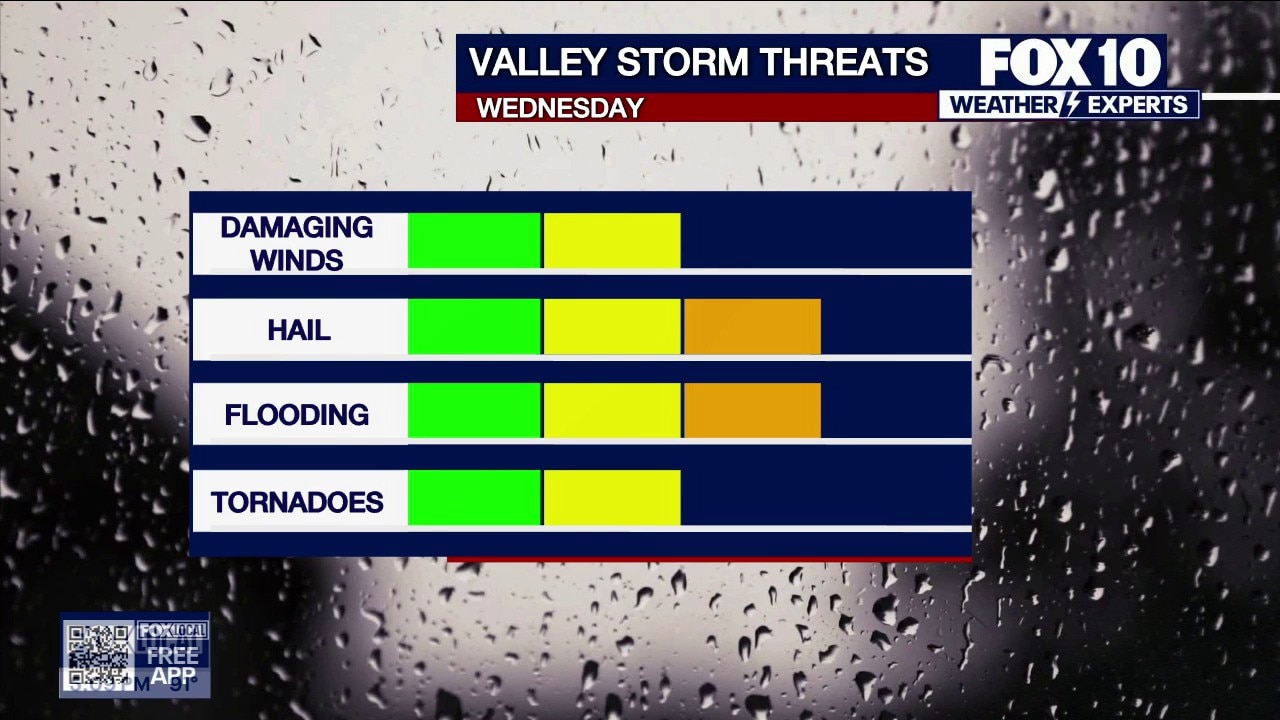
Severe storm threat includes hail, flooding and tornadoes
Arizona faces a severe storm system bringing heavy rainfall, flood watches, large hail, and potential weak tornadoes from Phoenix to the high country. FOX 10's Erica Horvatin has the latest forecast.
PHOENIX - Plenty of change is expected over the next several days.
What Happened Today:
Tuesday was a warmer and mostly dry day. Phoenix hit a high of 93 degrees. Moisture is moving northward, bringing clouds into the Valley this evening. Showers and thunderstorms will be possible around the Valley and the high country late tonight.
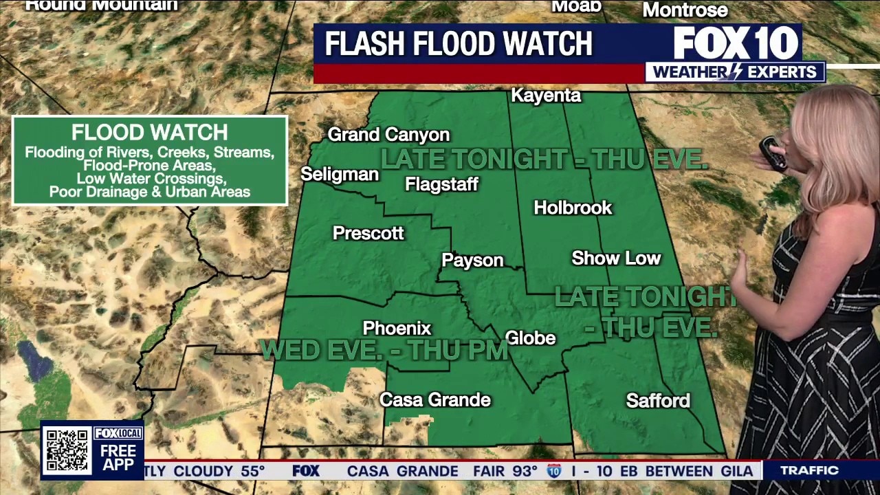
Flash flood watch issued across Arizona
The National Weather Service has issued flood watches across Arizona as heavy rain and severe storms are set to move into the region.
Storms Brewing:
The weather pattern becomes more favorable for stormy weather beginning tonight into Wednesday morning. A Pacific low is swirling off the California coastline and will begin to slip southeast through Wednesday. As this happens, it will funnel more moisture toward Arizona. This increases storm chances as soon as tonight.
This evening, more spotty showers and thunderstorms will develop around Arizona, especially in northern parts of the state. This continues Wednesday morning as the low pressure center continues to creep closer to the Southern California coastline. The morning will be mostly dry and cloudy, with some spotty showers and thunderstorms in the high country.
By Wednesday afternoon, thunderstorms will become more numerous and spread across the state. Some of the thunderstorms are forecast to turn strong to severe continuing into the afternoon and evening on Wednesday. The top threats with any severe storms will be damaging winds, flooding, and hail. There is also a low risk for tornadoes to develop under this weather pattern. The severe storm risk is heightened around Phoenix and areas to the north and east portions of the state.
In Phoenix, the most likely period of heavy rain is between Wednesday night and Thursday morning. Additional heavy to severe storms will continue in waves through Thursday morning and shift eastward through Thursday afternoon and evening. By Friday, the state will dry out.
Flood Watches:
The National Weather Service offices across the state have issued flood watches in response to the threat of heavy rain, too. A flood watch is in effect for most of Arizona, including southern counties of Maricopa, Pinal, Gila, Graham and Greenlee counties, and all of the high country. Flash flooding of creeks, washes, swimming holes, burn scars, low water crossings and urban areas is expected.
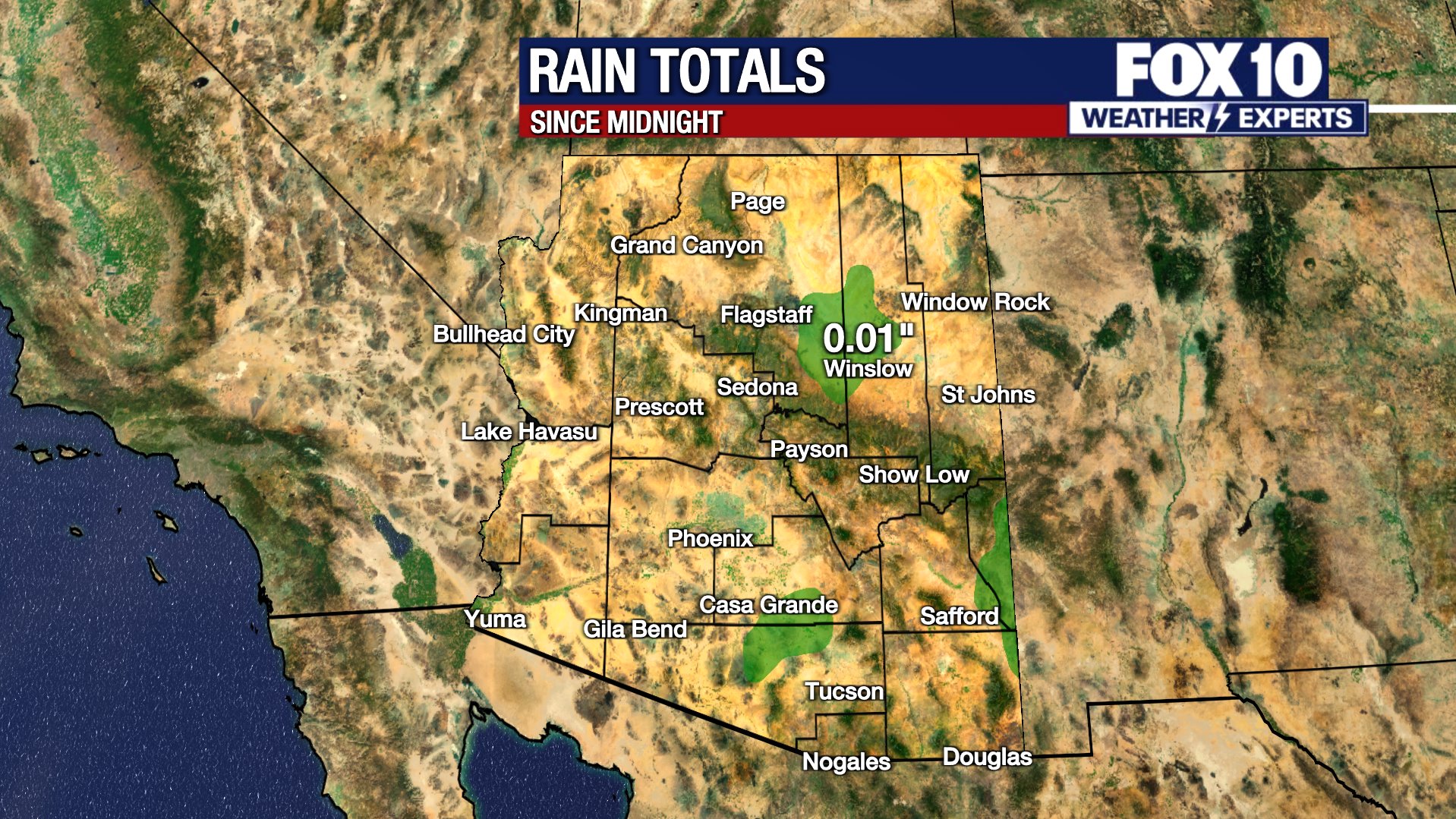
Between Tuesday night and Thursday night, rain totals may reach 0.25 to 0.75 inches, or more with any strong thunderstorms, in Phoenix. Totals from 1 to 2.5 inches or more will be possible over higher terrain to the north and east of Phoenix, like around the Mogollon Rim.
Change in Weather Patterns:
Severe storms are also expected, with the main threats being large hail over 2 inches in diameter, and damaging wind gusts of 60 to 70 mph. Another threat will be a one or two weak tornadoes, which have the best chance of happening over the high country.
Winds will be gusty in northern Arizona on Wednesday, at 25 to 35 mph. Thursday will be even windier in the high country, with gusts of 35 to 45 mph. The Valley will also see breezy winds Thursday, with gusts up to 25 mph.
Temperatures will be a bit cooler Wednesday and Thursday, but the air will feel muggy. Drier air will drop the humidity on Friday, and temperatures will fall into the upper 70s and low 80s in the Valley.
You can always check the latest weather conditions by visiting the FOX 10 Phoenix weather page, or download the Free FOX 10 Weather app, which is available on Apple iOS and Android.
Scroll down this page for satellite and radar, day planner, records, current temperatures, 10-day forecast, forecast highs, and recent rainfall totals, plus live video feeds.





The following heat safety information was provided by the Scottsdale Fire Department.
What are Heat Emergencies?
Heat Cramps: Profuse sweating, fatigue, extreme thirst, muscle cramps
Heat Exhaustion: Headache, dizziness, weakness, nausea/vomit, Cool/moist skin
Heat Stroke: Elevated temp. +103degrees, confusion/irrational behavior, dry/hot skin, rapid shallow breathing, rapid weak pulse (shock), seizures, unconscious
What to do
- Get person into shade or cool location.
- Cool person with cool, wet cloths (neck, groin, armpits, head) and fan body.
- Sip cool water if person is alert.
- For muscle cramps, massage muscles gently, but firmly until relaxed.
- *If symptoms worsen, call 911.
What not to do
- Do not give anything by mouth if person is vomiting, unable to swallow or unconscious.
- Do not underestimate the seriousness of a heat emergency.
- Prevention/Preparation for hike/exercise in heat.
Know your limitations
- Hydrate (begins day prior to hike/exercise, hour before hike, during and after).
- Wear proper clothing, lightweight and light color, protect head, proper shoes.
- Always carry a cell phone and best to hike with company.
- Always tell someone where you are hiking and when to plan to return.
Preventing heat exhaustion/heat stroke
The Arizona Department of Health Services stated the following precautions can be taken to prevent heat exhaustion or heat stroke:
- Stay in air-conditioned buildings.
- Find a cooling center/hydration station.
- Limit outdoor activity during the hottest part of the day (mid-day).
- Check on at-risk friends, family, and neighbors at least twice a day.
- Drink water before, during, and after working or exercising outside.
- Check the UV Index.
- Check the heat risk map.
Road Conditions
- Call 511 anywhere in Arizona or 1-888-411-ROAD (7623)
Rain/flood safety tips
The American Red Cross' tips for heavy rain situations and flood safety:
- Turn around don’t drown! If you must drive and you encounter a flooded roadway, turn around and go another way.
- If you are caught on a flooded road and waters are rising rapidly around you, get out of the car quickly and move to higher ground.
- Tune in to your local radio, NOAA radio, or news channels for the latest updates.
- If your neighborhood is prone to flooding, be prepared to evacuate quickly.
- Follow evacuation orders and do not attempt to return until officials say it is safe.
- If power lines are down, do not step in puddles or standing water.
- If power is out, use a flashlight. Do not use any open flame as alternate lighting.
Preparing for a severe thunderstorm
The American Red Cross' tips for preparing for a severe thunderstorm:
- Put together an emergency kit.
- Know your community’s evacuation plan.
- Create a household disaster plan and practice it.
- Purchase a battery-powered or hand-crank radio
- Discuss thunderstorm safety with members of your household. Be aware that a thunderstorm could produce flooding.
- Pick a safe place in your home for household members to gather during a thunderstorm. This should be a place where there are no windows, skylights, or glass doors, which could be broken by strong winds or hail and cause damage or injury.
The Source: Information for this article was gathered by the FOX 10 Weather Experts.