

Huge Sahara dust cloud to impact Florida, Louisiana, and more this week
Tire tracks cut through the sands of the Sahara Desert, the source of vast dust plumes that travel thousands of miles across the Atlantic each year, affecting air quality and weather from the Caribbean to the United States. (Photo by SOULEYMANE AG ANARA/AFP via Getty Images)
LOS ANGELES - A sprawling dust plume from the Sahara Desert is making its way across the Atlantic Ocean, blanketing the Caribbean in haze and stirring up health concerns.
The system, the biggest of its kind so far in 2025, is expected to reach parts of the southern United States—including Florida and Gulf Coast states—later this week.
The plume has already caused sneezing, coughing, and reduced visibility across the Caribbean. Experts say the Saharan Air Layer can also impact weather patterns by suppressing hurricane development, making this dust event particularly notable as the Atlantic storm season gets underway.
How large is the 2025 Sahara dust cloud?
By the numbers:
According to the National Weather Service and AccuWeather, the current plume is:
- 2,000 miles wide from Jamaica to past Barbados
- 750 miles long from Turks and Caicos to Trinidad and Tobago
The dust concentration, measured at .55 aerosol optical depth, is the highest recorded so far this year. That metric indicates how much sunlight is blocked by airborne particles.
Where and when will the dust reach the US?
What's next:
The dust is expected to arrive in parts of the southern United States—especially Florida, Louisiana, Alabama, and Mississippi—by late this week and into the weekend, according to AccuWeather meteorologist Alex DaSilva.
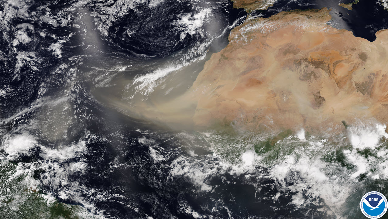
A Saharan dust plume closes in on the U.S. coast
The densest plume of dust developed off Western Africa and has traveled nearly 5,000 miles across the Atlantic Ocean.
While much of the dust thins out before reaching the mainland, elevated levels can still affect air quality and reduce visibility.
What are the effects of Sahara dust on health and weather?
Why you should care:
The Saharan Air Layer forms over Africa and travels westward across the Atlantic between April and October. While the dry air can suppress hurricane formation, it also carries fine dust particles that may cause respiratory irritation, especially in people with asthma or allergies.
Caribbean health officials are urging people to stay indoors or wear face masks when outside. These plumes usually reach their peak concentration in June and July, with dust traveling at altitudes between 5,000 and 20,000 feet.
What they're saying:
"It’s very impressive," said Alex DaSilva, lead hurricane expert at AccuWeather, referring to the scope of the dust event.
"This is the highest amount so far this year," said Yidiana Zayas, a forecaster with the National Weather Service in San Juan, Puerto Rico, referencing the .55 aerosol optical depth reading.
The Source: This article is based on Associated Press reporting from San Juan, Puerto Rico, and includes meteorological data and expert commentary from the U.S. National Weather Service, NOAA, and AccuWeather.